Carlingford Lough case study
Carlingford Lough is a sea lough at the mouth of the Newry (or Clanrye) River on the east coast of Ireland, bordering both the Republic of Ireland (County Louth) and Northern Ireland (Counties Down and Armagh). The upper reaches of the Lough are shallow and dominated by fine muddy sand beds and intertidal mud-flats, whilst the seaward entrance to the Lough is a mixture of boulder, cobble and bedrock forming numerous small islands and reefs.
As a trans-boundary water body Carlingford Lough has a range of regulatory and management issues, one example of which is the spatial conflict between Aquaculture and nature conservation. The areas of Carlingford Lough within Northern Irish jurisdiction have been designated as a Special Protection Area (SPA) for breeding Sandwich and Common Terns and overwintering (non breeding) Light Bellied Brent Geese, an Area of Special Scientific Interest (ASSI), an Area of Outstanding Natural Beauty (AONB) a RAMSAR site (as designated under the Convention on Wetlands of International Importance (also known as the Ramsar Convention) and a proposed Marine Conservation Zone (MCZ). The areas of Carlingford Lough within Southern Irish jurisdiction have been designated as a Special Area of Conservation (SAC) for the Annex I habitats Annual vegetation of drift lines and Perennial vegetation of stony banks, a SPA for overwinter (non breeding) Light bellied Brent Geese and a proposed Natural Heritage Area.
In the Northern side of Carlingford Lough the Department of Agriculture and Rural Development (DARD), Fisheries and Environment Division is responsible for the granting of fish culture licences, shellfish fishery licences and marine fish fishery licences under the Fisheries Act (Northern Ireland) 1966. In the Southern side of Carlingford Lough the Aquaculture and Foreshore Management Division of the Department of Agriculture, Food and the Marine (DAFM) is responsible for aquaculture licensing under the Fisheries (Amendment) Act, 1997.
Aquaculture within Carlingford Lough
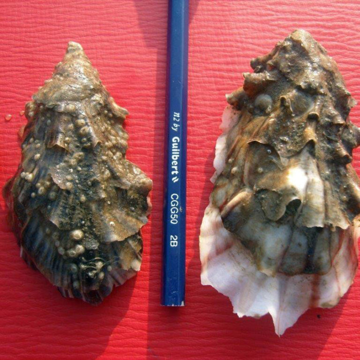
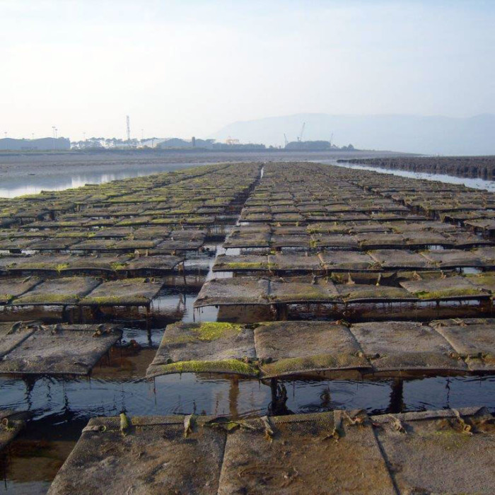
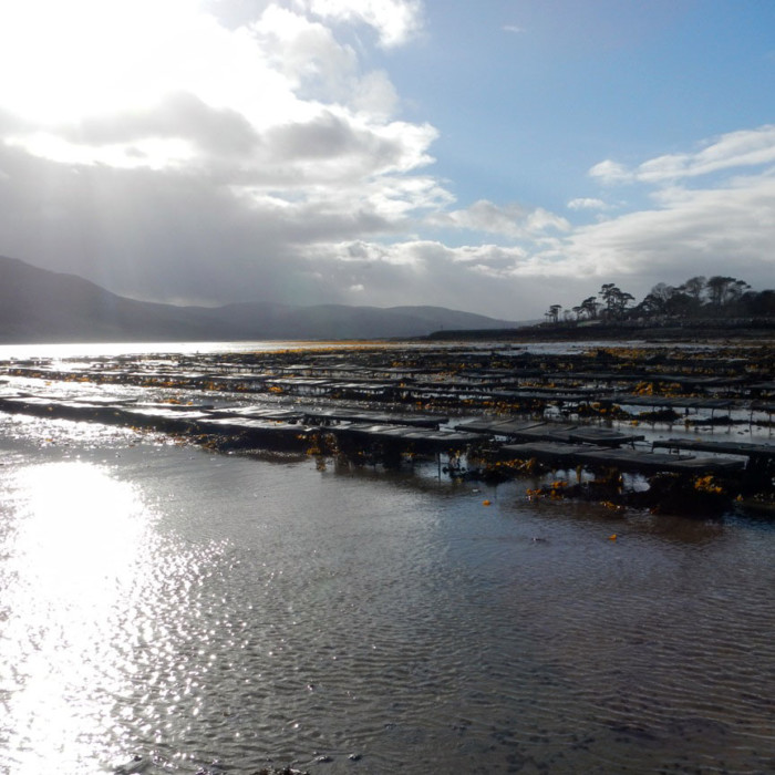
Aquaculture within Carlingford Lough occurs on licensed sites within both the intertidal and subtidal areas of the Lough. Subtidal aquaculture involves the bottom culture of the blue mussel Mytilus edulis, whilst intertidal aquaculture occurs predominantly in the form of off-bottom (trestle) culture of the Pacific oyster Crassostrea gigas. M. edulis seed is dredged from naturally settled wild seed mussel beds (outside Carlingford Lough) then relaid onto licensed aquaculture beds within Carlingford Lough for on growing to harvestable size.
In Northern Ireland the DARD Fisheries and Environment Division is responsible for the granting of fish culture licences, shellfish fishery licences or marine fish fishery licences under the Fisheries Act (Northern Ireland) 1966. In Southern Ireland the Aquaculture and Foreshore Management Division of the Department of Agriculture, Food and the Marine (DAFM) is responsible for aquaculture licensing under the Fisheries (Amendment) Act, 1997.
Aquaculture sites licensed for bottom culture of shellfish cover approximately 931 hectares of the subtidal area of Carlingford Lough and approximately 240.1 hectares of the intertidal area of the Lough is licensed for the off bottom (trestle) culture of oysters. The total area of Carlingford Lough (both intertidal and subtidal) is estimated to be approximately 4,890 hectares (as calculated in ArcGIS). Therefore approximately 23.9% of the total area of the Lough is licensed for aquaculture. However not all of these licensed sites are currently active and of those sites that are active, not all of the licensed area is utilised for shellfish cultivation.
The situation in Carlingford is further complicated by the wide range of overlapping stakeholders competing with the aquaculture industry for space. Some examples include; the wild mussel fishery, inshore pot fishing, the commercial port at Warrenpoint, the local leisure industry, nature enthusiasts and a proposed local ferry development.